Reading the Sky: Identifying Rapid Pressure Drops
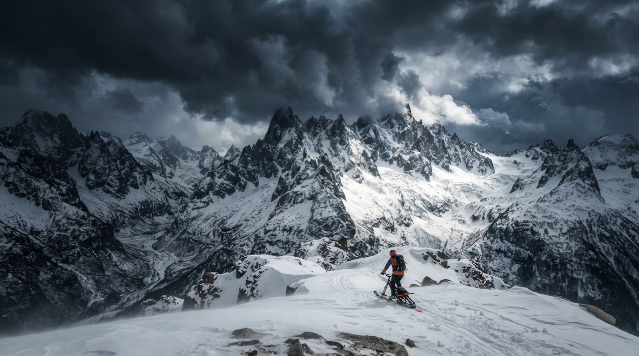
The mountains write their weather forecast across the sky hours before it arrives, but only if you know how to read it. Learning to spot a rapid pressure drop and its visual warning signs can buy you the time you need to get off an exposed ridge before conditions turn against you.
Why Pressure Drops Matter in the Mountains
Atmospheric pressure and weather systems are directly linked: a falling barometer generally signals an approaching low-pressure system, which typically brings wind, precipitation, and instability. In mountain terrain, these shifts arrive faster and hit harder than they would at lower elevations, because ridgelines and passes funnel and accelerate wind while offering little shelter.
A slow, steady pressure drop over many hours often means a system is still some distance away. A rapid drop — noticeable over just a few hours — is the signal that should get your full attention, since it often means the system is arriving faster than the forecast anticipated.
Cloud Signs Worth Watching
Clouds are one of the most reliable early indicators of a shifting system, and you don’t need instruments to read them.
- Cirrus clouds: Thin, wispy, high-altitude clouds that often arrive 12 to 24 hours ahead of a frontal system. Watch for them thickening and lowering over time.
- Lenticular clouds: Smooth, lens-shaped clouds that form over and downwind of peaks, indicating strong winds aloft even when it feels calm at your elevation.
- Building cumulus: Fair-weather clouds that grow taller and darker through the day can signal instability and the potential for afternoon storms.
- A lowering, thickening overcast: Cloud decks that descend and thicken over a few hours typically precede precipitation.
Wind Loading and Its Avalanche Connection
Falling pressure is frequently accompanied by rising wind speeds, and wind is one of the most important factors in avalanche formation. Wind strips snow from windward slopes and deposits it on leeward slopes, building dense wind slabs that can sit on top of weaker layers.
- Watch for snow plumes streaming off ridgelines — a clear sign that loading is actively happening.
- Cornices growing on the downwind side of a ridge are a visible record of which slopes are being loaded.
- Freshly deposited snow that looks smooth, rounded, or “pillowed” rather than textured can indicate a wind slab.
A rapid pressure drop combined with visible wind loading is a strong cue to reassess your planned route, especially on slopes with a similar aspect to where you’re seeing deposition.
Tools for Tracking Pressure Trends
You don’t need to rely on the sky alone. A few tools make pressure trends easier to track objectively.
- A wrist-mounted or handheld barometric altimeter, which many outdoor watches include, showing you pressure trend graphs over recent hours.
- Mountain-specific weather apps that provide point forecasts, wind models, and pressure trend data for the exact zone you’re traveling in.
- A simple habit of logging pressure readings at every rest stop, so a sudden drop stands out against your own data rather than requiring you to remember an earlier reading.
Keep in mind that a barometric altimeter reads elevation based on pressure, so an unexpected change in your elevation reading at a known point is itself a clue that pressure — and likely the weather — is shifting.
When to Turn Around
Deciding to retreat is rarely comfortable, but the visual and instrument cues above exist so you don’t have to wait until you’re caught in deteriorating conditions to act.
If you notice a rapid pressure drop, thickening cloud cover, and increasing wind at the same time, treat that combination as a decision point, not a data point to monitor further.
Set a turnaround time before you leave, and honor it even if the summit or the best line feels close. Retreating early on a marginal read costs you a run; getting caught by a fast-moving mountain storm can cost far more.
Responsible use note: Reading sky and pressure cues is a supplementary skill, not a replacement for checking official mountain weather and avalanche forecasts before every trip. Combining these observations with sound decision-making requires formal backcountry and avalanche training — this article is intended as an educational overview only.